Alpengletscher
Mensch und Eis

Alpine Glaciers

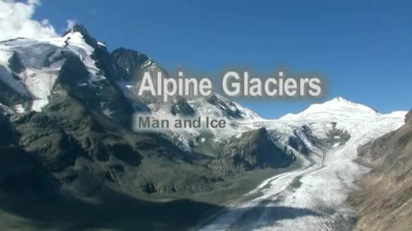
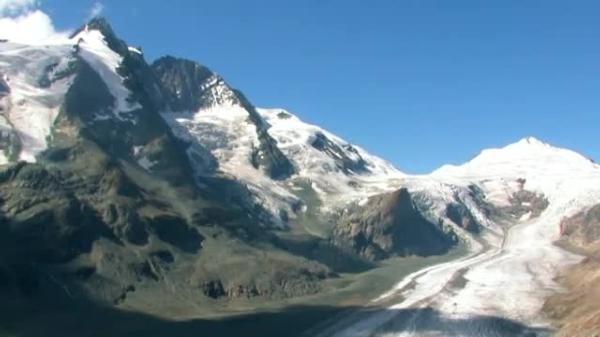
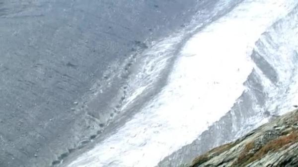
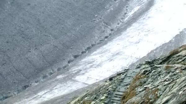
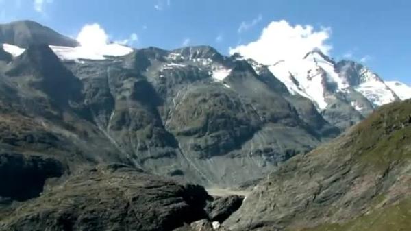
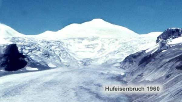
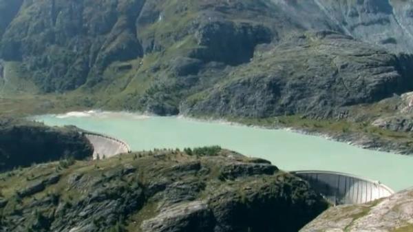
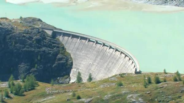
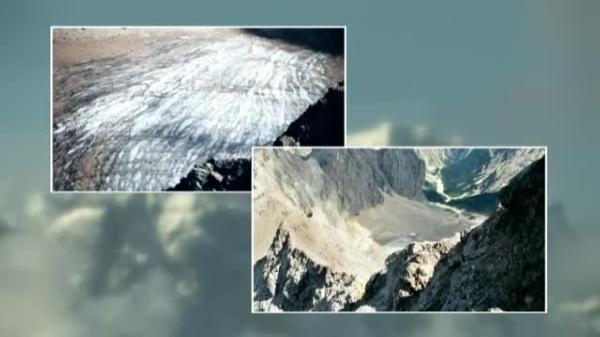
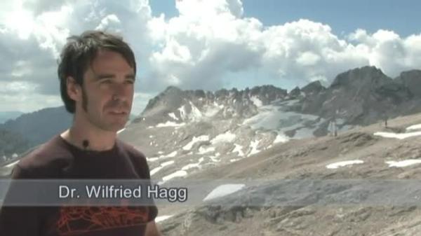
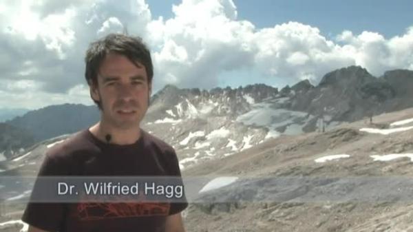
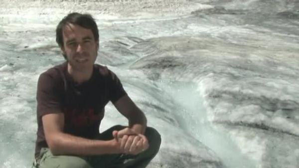
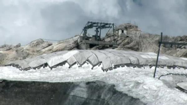
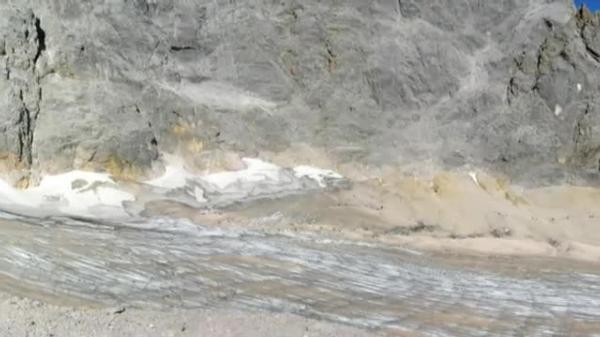
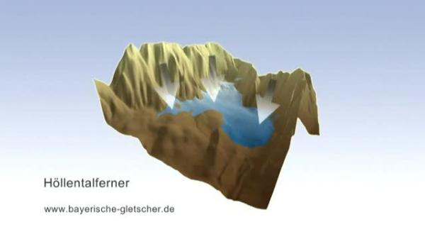
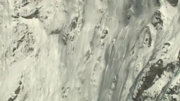
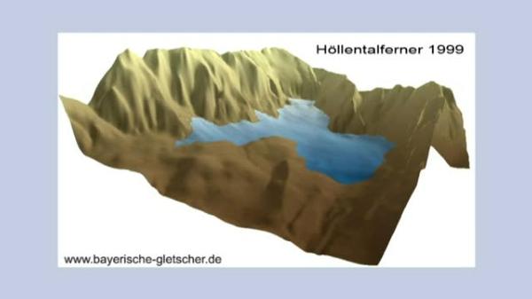
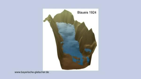
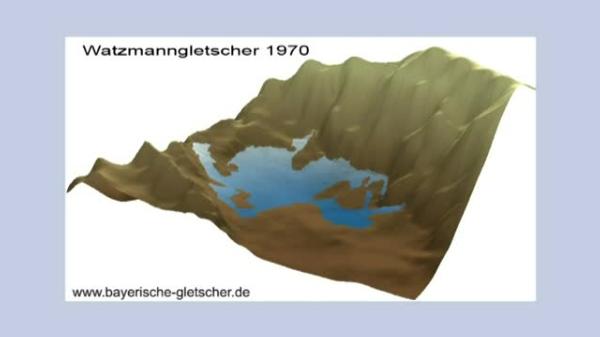
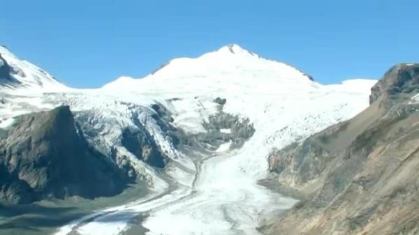
1. Snowline and Ice Formation Climatic development and man‘s influence on it is being hotly debated in public. Glaciers and their environment are testimonies to climatic developments then and now. The Alps are the highest Central European mountain range dividing the continent like a barrier. The mountain massif is home to numerous glaciers. Austria is strongly marked by the Alps which reach their greatest altitude within the country with the Hohen Tauern. That‘s where the Pasterze is located. Over 8 kilometres long, an area of 18 square kilometres and a volume of 1.8 cubic kilometres, that is thePasterze, the biggest glacier of the eastern Alps at the Großglockner, with 3798 metres the highest mountain of Austria. How can such huge masses of ice be formed? The origin of the glacier ice is the snow that falls in the higher mountain regions and remains there. The dividing line above which the snow doesn‘t melt throughout the year is called the climatic snow line. This snow line is higher in the Central Alps than on their northern and southern boundaries . If you look at a cross-section of the Alps, it is demonstrated by the existing glaciers that the snow line to the north is at an altitude of about 2500 to2800 metres and to the south at an altitude of about 2700 to 2800 metres. This depends upon the precipitations at the boundaries of the Alps. Apart from the temperatures it‘s the precipitations, too, that are responsible for the altitude of the snow line. In the Central Alps, where the Pasterze is situated, the snow line runs at an altitude of about 2900 to3200 metres. Below this icy region, the rocks, the alpine meadows, the alpine pastures with crooked brushes and then coniferous forests follow. This zone then merges into the hilly area where the deciduous forest naturally dominates the landscape. How then is the ice of the glaciers formed? Through its weight the fallen snow compresses the layers below and through the meltwater that seeps into the lower layers and freezes there the ice of the glacier is formed. During this process pollutants and air are enclosed and cause the typical streaking of the ice. 2. Structure and Characteristics of Glaciers The lower end of the Pasterze, the so-called glacier tongue, is at an altitude of about 2100 metres, that is nearly one kilometre below the above mentioned snow line. How does the ice get there, if there is no perennial snow in this relatively low region? This can only happen because the ice moves downhill. If more and more masses of ice form above the snow line they begin to move at one time or other independently of their mass or the incline of the subsoil and move downhill following the ground. The region above the glacier is called the supply area of the glacier because there more ice forms than melts. When the ice moves towards regions below the snow line, to the so-called consumption areas, melting processes prevail more and more. In summer there is no blanket of snow any more, so the sheer glacier ice appears. The more the ice descends the slope the greater are the losses of ice until eventually the ice has completely melted at the glacier tongue. A glacier may grow or melt, but it always moves downhill. When it melts it moves more slowly than when it grows and increases in volume. A growing glacier can be recognized at its steep front. The flat tongue of the Pasterze shows that it is a melting glacier, whose ice masses move at an average speed of 30 to 40 metres a year. During this process the glacier cave is reshaped again and again. Outstanding features are the lumps of ice that break off the crumbling glacier and are left behind as kettle blocks of ice. There are meltwater rivulets on the surface of the glacier, too. In some places, the so-called glacier shafts, water flows into the glacier and forms whirlpools which hollow out so-called corries. Especially notorious and dangerous are the crevasses, which are mostly formed where the ice is torn open because of steep slopes and terraces in the rocky ground. Constantly scree from the surrounding slopes crashes onto the surface of the glacier and is carried off by it. This scree is called surface moraine material. When two branches of the glacier merge, the scree transported along the sides, the lateral moraines, forms a medial moraine which is bordered by ice on both sides. A rock or mountain that is surrounded completely by ice like the small Burgstall here, is called Nunatak, a term of the Inuit language. 3. Glacial Retreat and Area in front of the Glacier In recent times the alpine glaciers had their greatest expansion in the year 1852, the Pasterze then reached down to the Margaritzen reservoir in the Margaritzen basin. The greatest expansion of a glacier is indicated by scree hills , so-called terminal moraines. Since then, the Pasterze has lost almost two kilometres in length and can‘t be seen any more from this position. The changes of the glacier since 1960, though, can be seen clearly. The glaciers of the Großglockner have retreateded considerably. The area of the horseshoe rupture that separates the upper part of the glacier at the Johannisberg from the glacier tongue down in the valley is especially conspicuous. While the horseshoe rupture was still completely covered by ice in 1960, numerous rocky patches can be seen today. The supply of ice could soon come to an end and the small Burgstall would no longer be surrounded by ice , which is mostly covered in scree already today. The decrease in depth of the glacier can be seen especially clearly at the bottom station of the glacier railway, built in 1963 immediately above the glacier surface, which is now about 100 metres below it. In the Middle Ages the Pasterze, whose name means ‚meadow‘ or ‚pasture‘, was considerably smaller than today, like practically all glaciers of the Alps. In the modern age the glaciers increased until 1852. Since then the size of glaciers has dwindled until their present-day size, interrupted only by short pediods of advance. The ice melting at the glacier end today was formed around the late Middle Ages. The glaciers are the clearest, visible sign of climatic warming. The share of man in it and of the greenhouse gases he emits, such as carbon dioxyde, are being discussed very controversially. During the Ice Ages glaciers covered large parts of the Bavarian foothills of the Alps, there you find lakes, bogs, villages and towns. When the glacier melts, it leaves behing quite large surfaces which are formed by the englacial stream, here the Möll, through the force of water. Blocks of ice left behind here are called kettle ice, just like parts of the tongue that have stopped moving. This area in front of the glacier which is soon covered by plants is a really primeval landscape. The water of the Möll is cloudy and this is called glacier milk. This clouding comes from very fine sediment particles ground down from the soil by the glacier and its freezed-on scree. This erosion activity of the glacier is demonstrated later on by the typical scratches on the smooth, ground-down rock. After the melting of the Pazerne a basin was exposed that soon filled with water and sediments from the Möll. This basin, which is only rarely filled with water today, is called a sander lake. The term sander is derived from the Icelandic language and denotes surfaces covered by sediments of glacial rivers. The sediment is clearly finer than sand. The typical sequence of ground moraine, terminal moraine and sander is called glacial series.4. The Use of the Glaciers Glaciers are of great significance not only for the balance of nature but also for the economy of the alpine countries. The Margaritzen reservoir, largely fed by the Möll, was put into service after the construction of two dam walls in 1952. It is is used for the generation of electricity but at the same time is still filled up with the sediment carried down from the glacier by the Möll, just like the sander lake.Thus the functioning jof the reservoir has been increasingly endangered since 1990. Although water power is a clean source of energy, it is clearly demonstrated here, how man interferes with nature. Glaciers are water reservoirs and have a regulating effect on the balance of nature. Precipitations, which would be swept away unproductively by streams and rivers in a relatively short time, thus are utilized over a longer period. The glaciers play an especially important role for summer tourism, in particular here in the nature park of the Hohen Tauern. They are a site of attraction for many people. The Großglockner alpine road alone has been travelled on by about 50 million people since its opening in 1935. The glacier itself is visited by numerous tourists from all over the world. Especially to people from warmer countries a chance is offered here to see snow and ice in agreeable outdoor temperatures, which is impossible in their home countries. A particularly strong attraction is exerted by the colours of the ice and its reflexions. As human interest in environmental processes has been increasing steadily since the 1970s, the changes of the glacier itself and the ensuing consequences have become a focus of interest. Precisely for this reason the glacier trail, planned in 1982, was solemnly opened in 1983 by the Austrian Alpine Association. Many people don‘t know that there are glaciers in Bavaria, too. All in all there are five smaller glaciers, three of which are situated near the Zugspitze, namely the northern and southern Schneeferner on the Zugspitzplatt and the Höllentalferner in the Höllental cirque. The Watzmann glacier and the Blaueis at the Hochkalter are located in the Berchtesgaden region. The Zugspitze with an altitude of 2962 metres the highest mountain in Germany, is also the aim of many thousands of tourists from at home and abroad, who can comfortably reach the summit in a rack railway or two mountain railways. The two Schneeferners also have economic importance as they prolong the skiing season until late spring. Sometimes the region is called the only summer skiing area in Germany, but for decades this hasn‘t been true any more, as the glaciers have become impassable in summer. Because of the movements of the ice the buttresses of the ski lift had to be relocated. But in general the significance of the alpine glaciers for ski tourism is still enormous.5. Zugspitz Glaciers The glaciers in Bavaria are seriously affected by melting, too. The changes of the Bavarian glaciers hasve been researched into for years by Dr.Hagg at the Ludwig-Maximilians-University in Munich. Statement Dr.Hagg: Around 1850 we had the last peak period of the alpine glaciers. Then also the Zugspitzplatt was entirely covered by a big glacier - the Plattferner - which then, towards the end of the 19th century, dissolved into two smaller glaciers, the southern Schneeferner which we see here in the background and which has melted so much that it is likely it won‘t be called glacier any more very soon and the northern Schneeferner which is located a little to the right here and is still Bavaria‘s highest glacier today. In the last 150 years temperatures at the Zugspitze have risen 1° Celsius and the 1990s were the hottest decade ever since there were temperature recordings. In that decade this glacier lost about 80 cm of its depth every year. And in the extremely hot summer of 2003 every day 35 million litres of water melted there, which roughly corresponds to one tenth of the water consumption of Munich and its surroundings. If this glacier keeps on retreating at that rapid pace in the future, the northern Schneeferner will have disappeared completely within about 20 years. In spite of its relatively small size compared to the Pasterze the northern Schneeferner shows clearly that small glaciers may be of commercial value, too. To secure its future usability the glacier is covered over with protective tarpaulins around the top station of the ski lift. This is to prevent the ascent for the lift users from becoming inaccessible in case of a further melting of the ice in this area. Moreover, snow is transported onto the glacier with the help of piste caterpillars, which is called ‚snow farming‘. The southern Schneeferner, which carries ski lifts, too, shows only few crevasses that may indicate a movement of the ice. So it is debatable whether it can still be considered a glacier. The eastern Schneeferner cannot be called a glacier any more. It has melted with the exception of a few irrelevant patches of firn and ice. In few decades also the northern Schneeferner will present the same picture. The third glacier at the Zugspitze is the Höllentalferner whose snout can be seen from the Zugspitzsummit. The glacier is well protected against the sun from the south by towering rock faces. The tongue of the glacier has got a lot of clearly recognizable crevasses that show that the movement of the isce is still relatively strong. The loss of ice on account of melting is relatively small, as it is shielded from the sun. The Höllentalferner is about one kilometre long and 700 metres wide.6. The Bavarian Glaciers as Climate Indicators If you look at the glacier from the other, the northern side, you realize that there is an additional reason for its relatively good condition. Because of the sheer rock faces surrounding the glacier, considerable amounts of snow are added in winter by avalanches. Such a glacier is called avalanche basin glacier. Animated digital elevation models demonstrate the change of glaciers in a particularly impressive way. With th help of a computer a three-dimensional model of the landscape is created on which the glacier data of different years can be noted. The digital elevation model of the Höllentalferner shows the changes of the glacier from 1950 till1999. Around the year 1980 an increase of the surface can be observed. This shows that a short period of advance intervened at that time. Since then the glacier has retreated again. The Blaueis at the Hochkalter in the Berchtesgaden region is the northernmost glacier and the lowest-situated one of the Alps. This glacier shows a considerably clearer decline than the Höllentalferner at the Zugspitze. The following pictures illustrate how the ice has changed in 110 years. In the 1920s there was also a period of advance just as it was observed at the other alpine glaciers. In the 50s rock barriers emerged as a consequence of the loss of ice. Around 1980 there was a short period of advance here, too. Ever since the late 80s the glacier has been retreating. The last and not yet mentioned glacier of Bavaria is the Watzmann glacier. Here the documented period of time is 98 years. The Watzmann glacier had almost disappeared by 1959. A short advance can be observed in 1970. This advance intensified around the year 1980 here,too. Later the Watzmann glacier just like all other glaciers underwent marked melting processes. These pictures illustrate that especially small glaciers are very sensitive indicators, which react quickly even to small changes. Therefore the Bavarian glaciers are very important in climatology. Big alpine glaciers like the Pasterze, hardly show any such sensitive reactions, but have mostly gone on melting without interruption since 1852. The Schneeferners, however, because of their use for ski tourism are no longer suitable for climatic measuring, as ‚snow farming‘ severs them at least partly from the climate. To be able to make meaningful statements about climatic development, we will need meteorological data, too, of course. The climatological mountain station of the German Meteorological Service, opened in 1900 and the highest-positioned institution of its kind in Germany, has been supplying such data for more than a hundred years. The fact is that the alpine glaciers will go on melting, the travellers will be presented with quite a different view and especially the living conditions in the Alps will change.

